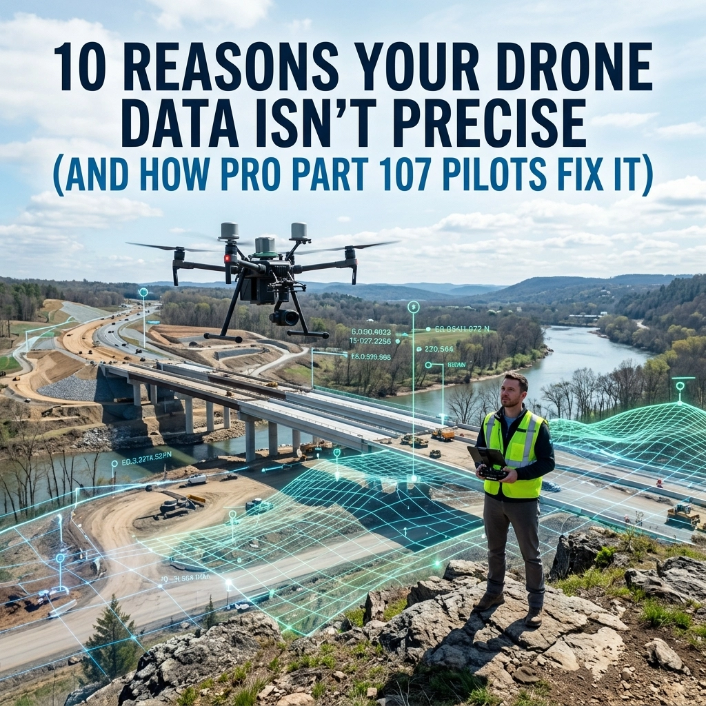
10 Reasons Your Drone Data Isn’t Precise (And How Pro Part 107 Pilots Fix It)
In the world of commercial drone operations, there is a massive divide between "taking a picture" and "capturing data." For […]
In the world of commercial drone operations, there is a massive divide between "taking a picture" and "capturing data." For […]

Enterprise drone operations are no longer a luxury for construction and property management firms in Southwest Florida: they are a
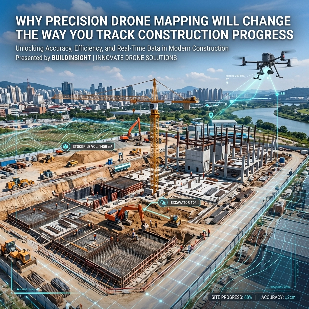
Precision drone mapping is fundamentally transforming construction progress tracking by delivering centimeter-level precision, real-time visibility, and complete site documentation in
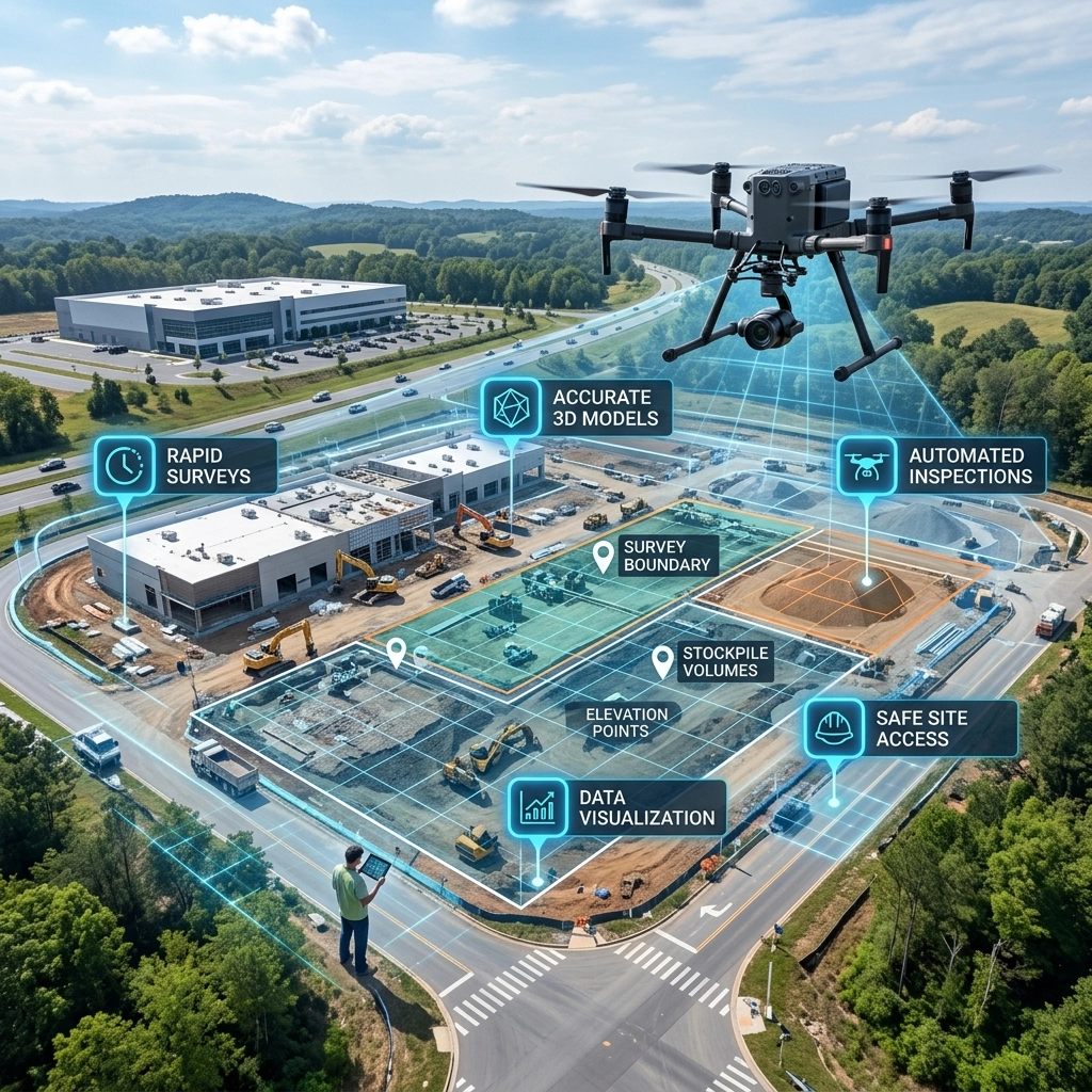
Traditional site inspections are inherently reactive: often slow, labor-intensive, and prone to human error. In the fast-moving world of Southwest

In the high-stakes world of Southwest Florida construction, information is the most valuable currency. For project managers in Cape Coral
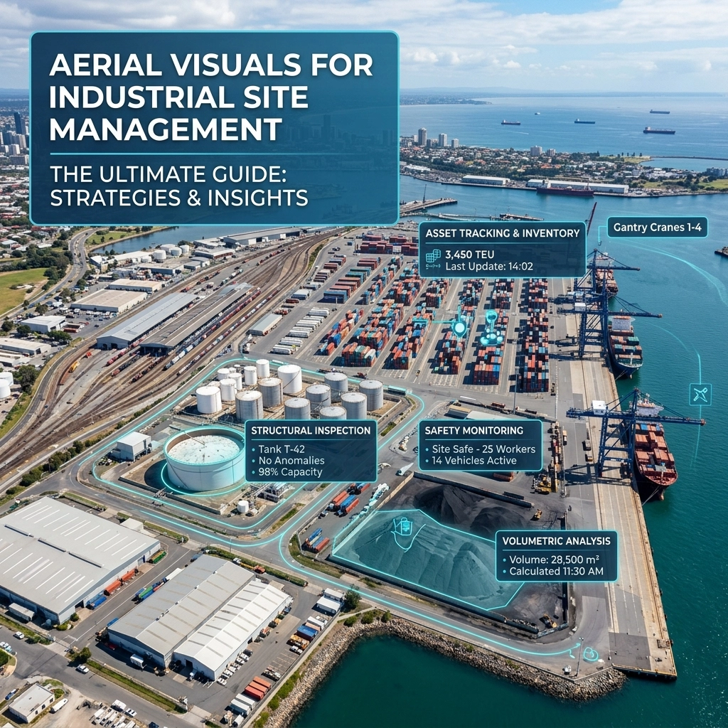
Industrial site management in the modern era requires a shift from manual oversight to data-driven intelligence. Aerial visuals: the integration
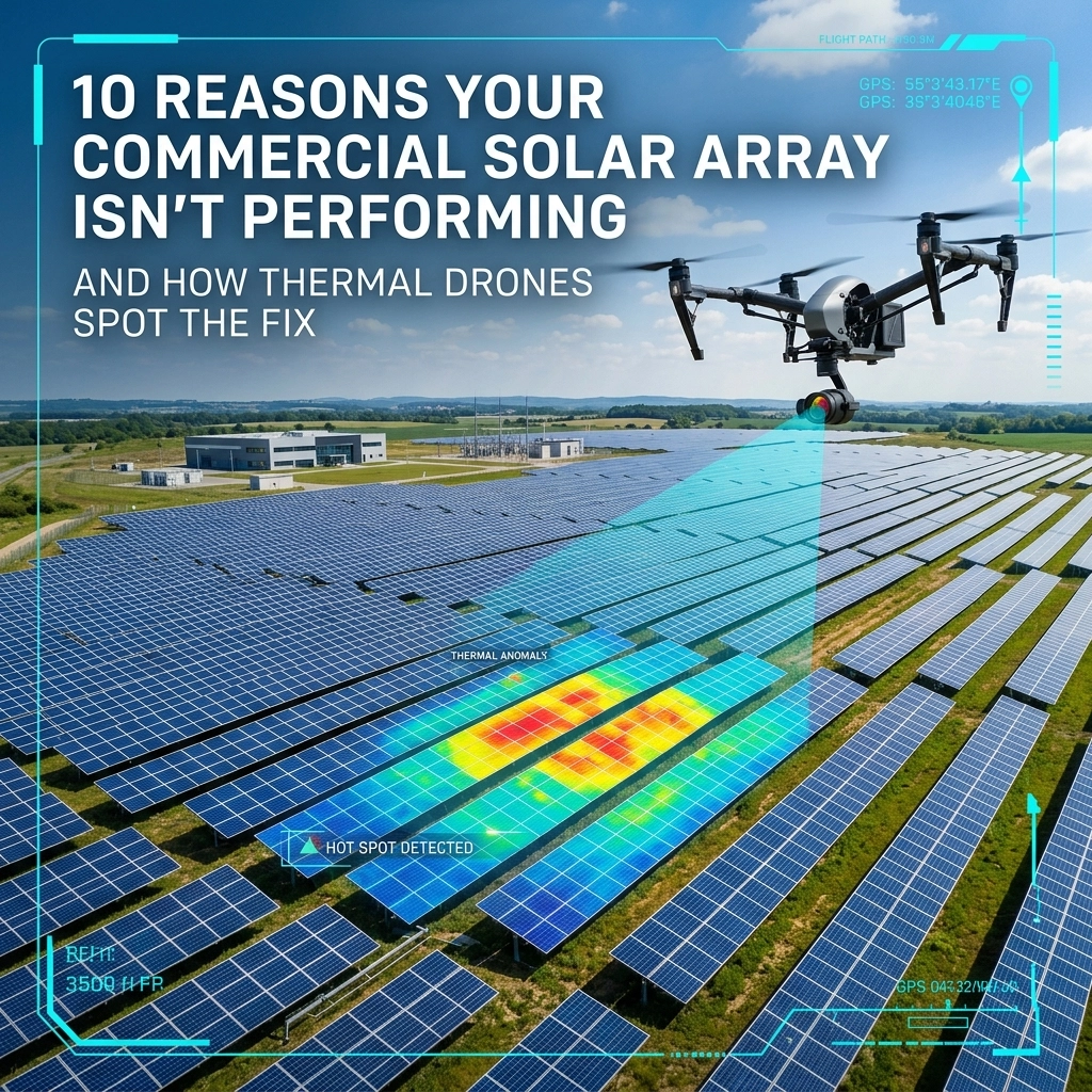
For a commercial property owner or facility manager in Southwest Florida, a solar array is more than just "green energy":
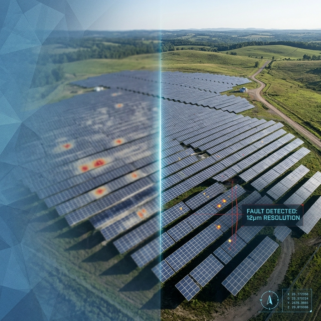
Thermal imaging has revolutionized how we maintain industrial assets, but not all thermal data is created equal. For solar farm

In the rapidly evolving landscape of Southwest Florida construction and property management, drones have shifted from "cool gadgets" to essential

Real estate drone services are no longer an optional luxury: they are a baseline requirement for high-stakes property transactions in